Pages

Friday, 1 December 2017

Walking the Crane Valley, Part 1


Just to the south of the Grand Union Canal's Paddington Branch and Bulls Bridge, running parallel to the busy Parkway dual carriageway, is a small unobtrusive river flanked by woods called the Crane. At various points along its journey its natural path has been altered by human development – through pollution and some canalising – and its identity is sometimes hard to determine, but it remains one of the most natural rivers in London. To the north of the Grand Union Canal the river which feeds the Crane is called Yeading Brook, which begins its journey in Harrow.
The entrance to Cranford Country Park in autumn, 
viewed from the bridge over the River Crane
If you leave the busy Cranford Parkway Interchange on the south-west of the roundabout and take a small slip road tucked between the Parkway and the M4 motorway you will find the main entrance to Cranford Country Park, which technically is part of the neighbouring Borough of Hillingdon. At this point the river itself follows the boundary between the west London boroughs of Hounslow and Hillingdon, flanked by Avenue Park on the east side and Cranford Park on the west.
Nothing remains of the old manor house, the former residence of the Berkeley family, which was demolished in 1945. However within the grounds of the park you will find the small parish church of St Dunstan's, which dates from the 15th century and remains in use to this day. One quite notable thing about St Dunstan's, apart from its understated charm, is that it contains the interred ashes of the late comedy actor Tony Hancock.
Along the banks of the River Crane, viewed from the Cranford Park side
Perhaps the most unfortunate thing that history has inflicted upon Cranford Park is that, with the construction of the M4 motorway in the late 1950s, this beautiful expanse of land was effectively sliced in two. A small underpass behind St Dunstan's called Dog Kennel Covert connects walkers and cyclists to the northern section, which tracks the Crane north to where it intersects with the Grand Union Canal, while the vast majority of the park lies to the south of the motorway.
A footbridge over the River Crane, viewed from the Avenue Park side
It is this southern portion that makes for the most pleasant walking experience, with well maintained paths and a small iron footbridge which allows you to cross the river from Cranford Park to Avenue Park in neighbouring Hounslow. If you would prefer, you can follow the river quite easily as you walk south along the Hillingdon side, and as you walk you may catch sight of nuthatches and other small birds like the meadow pipit that have been spotted in this area, swooping across the wide open stretches beyond the thickly wooded section along the river itself. You may be more likely to see the giant metal birds taking off from the airport to the south west.
Berkeley Meadows in summer
A small road separates the broad expanse of Cranford Park from a smaller but perfectly formed park called Berkeley Meadows, which was once an area of marshy damp meadows used for grazing sheep and cattle, but which today has a good path, easy access to the river as it flows south, and a well maintained children's playground. It is now home to a wide range of wildlife including butterflies, birds, mammals and insects, and you may even glimpse the Kingfisher flying up and down the river. 
Beyond here we encounter our first challenge to our Crane Valley walk in the form of Bath Road, a noisy dual carriageway which forces a small detour east to where there are traffic lights. I find the practical benefit of the shops and supermarkets in Cranford (Indian, Polish and Tesco) make up for the inconvenience of the noise and detour.
A path leads from the river to Huckersby Meadows in Cranford
Recent developments have made it difficult to access the Crane directly from Bath Road, so its necessary to cut through Waye Avenue, a circular suburban street with access to a playing field at the southern end. From this field you can cross another small iron bridge across the Crane to the newly opened Huckersby Meadows, which has been revived by the London Wildlife Trust from a former car park and wasteland into a large stretch of land where cows now graze.
Huckersby Meadows is bordered to its west by Heathrow Airport's Eastern Perimeter Road, so if you want to follow the Crane further south it is better to stay on the east side and follow the path through Cranebank Park. This is well maintained with benches and information boards about the local non-human inhabitants, and as you walk you find yourself entering an oasis of remarkable peace and tranqillity, bar the periodic aircraft passing overhead.
The abundance of natural flora and fauna comes as quite a surprise given the highly urbanised environment of Hounslow, so the fact that you can find here an environment supporting a range of mammals like foxes, rabbits, weasels, moles and bank voles is remarkable. The very best time to walk this stretch of the river is in the warm dry months from May to September, as the southern part of the land can be prone to flooding in winter.
The benches along Cranebank make life easier for local artists
The Great South West Road presents the next challenge to anyone wanting to walk the Crane Valley in its entirety. It is a wide dual carriageway which also runs parallel to the Piccadilly line as tube trains briefly emerge into the light before reaching their final destination of Heathrow. The only way that presently exists to get to the south side of the road are traffic lights down at the junction with the A312 to the east. On the plus side it is worth reminding yourself that this is the most dramatic detour you will encounter throughout the whole of this route.
Having crossed the roaring danger of the Great South West Road you will be able to locate the Crane again by finding the entrance to the Causeway Nature Reserve beside an imposing advertising billboard. 
Winter sunlight through trees on the Causeway
The Causeway is a small but welcome respite from the surrounding roads and industrial estates of Hatton and North Feltham, a place where you can find damp-loving herbs such as Meadowsweet and Gipsywort growing amongst the grasses, and a cover for many small birds such as the blackcap or whitethroat.
Also, thanks to a well placed underpass, you can walk easily and safely south to the longer stretch of woodland which lies beyond known as Donkey Woods. Here you will encounter the first remnants of the local gunpowder industries that once filled the river with toxic pollutants. Just remember to wear your wellies. It can get muddy. Alternatively, as with Cranebank, you may wish to tackle it only in the warmer, dryer months of the year.
The view east from the raised boardwalk through Donkey Woods in late summer

The northern section of Donkey Woods has a raised boardwalk to take you across the wettest, widest section of the River Crane, while the southern section is easier to walk throughout the year. It is here, in amongst often dense woodland, that you will find the remnants of Hounslow's gunpowder industries of the past, and where the Duke of Northumberland's river also intersects with the Crane.

A remnant of one of the gunpowder factories, 
now reclaimed by nature and local graffiti artists
When you reach Staines Road at the end of Donkey Woods a crossing to your right will take you safely across the street to the shops and petrol garage, and it is behind this petrol garage that the entrance to Brazil Mill Woods is partially concealed.
Brazil Mill Woods, shown here in autumn, is quite well concealed behind a petrol garage
This part of the Crane Valley is just as wild as Donkey Woods, but the path is on higher ground so less prone to muddiness or flooding. At one point the river divides to form an elongated island, with two points along the rivers' journey south where footbridges enable you to cross to the broad expanse of rugged scrub and woodland in Hounslow Heath. Many years ago the Heath once covered an even larger area than it does now.
Brazil Mill Woods is certainly well concealed. The first time I attempted to walk the Crane Valley I was convinced that this stretch of the river had fallen into disuse and been closed off from human traffic. This is partially because when the petrol garage on Staines Road is busy the north entrance is rendered almost invisible to passersby, while at the southern end the river and accompanying pathway disappears under a railway bridge connected to a short but very dark tunnel. 
The gaping darkness of Cavalry Tunnel represents
more of an existential challenge to the walker than a physical one
Those brave enough to enter the darkness of Cavalry Tunnel will soon emerge into something of a post-apocalyptic wasteland, where rusting railway paraphernalia share space with abandoned home appliances, and high fences designating the boundaries of railway land from public land brutally slice up what has the potential to be a remarkable natural reserve.
This section of the Crane Valley is the least cared for. It reeks of the forgotten and unloved. However, the truly intrepid explorer who persists through thick bushes of blackberry, nettle, wild hawthorne, and countless empty cans of lager, will eventually be rewarded by their first sight of Pevensey Road Nature Reserve. Occupying the boundary of Hounslow and Richmond boroughs, this part of the Crane Valley has seen a lot of work by volunteers over the last year or two to improve paths and manage the woodland areas for the enjoyment of all.
A small footbridge takes the walker across a tributary of the Crane
at Pevensey Nature Reserve

Thursday, 8 June 2017

Strangely like home


Whenever Jane and I visit the Melbourne suburb of St Kilda, I always feel at home. My brother-in-law lives in this area, and it is just down the road from Elwood where he and Jane grew up. I don't know if he was consciously looking to get back to his roots, but strangely it is my own roots in Ladbroke Grove that St Kilda reminds me of the most.
There are other elements that contribute to this beyond the presence of family. The architecture is more low-rise, but it is rooted in the same late-Victorian period. The local train service through this part of Melbourne is an overground service, just like the kind that runs through the part of west London where I spent my childhood.
This simple confluence of elements - of nineteenth century architecture and an overground train network - always makes this place feel familiar to me when stepping off the train at Balaclava station. There is also graffiti art everywhere, not unlike the kind I used to see around the Westway and Portobello Road areas (much of Melbourne and its suburbs are covered in graffiti, mostly by fairly skilled hands), and this once working class area has been subject to the same process of gentrification as I have seen in London. How many people around the world, I wonder, if you say "Notting Hill" to them immediately think of such bourgeois icons as Hugh Grant or David Cameron? The image of the area constructed over the last two decades does not describe the multicultural area I knew as a child, nor the working class slum known by a colleague of my dad who knew the area in the 1950s.


In many ways this is a description of the way random similarities can evoke a similar feel in otherwise disparate regions. There are obvious differences between Notting Hill and St Kilda, not least the latter's close proximity to the beach, the presence of the Melbourne tram network, a free community bus, backpackers hostels, ice addicts stumbling around the streets instead of winos, and the fact that one of the largest local communities is not Afro-Caribbean but Jewish. These are subtle differences, but they don't alter the curious manner in which, perhaps more than any other part of Australia I have seen so far, this area always feels to me the most strangely like home.
Why should this be? Why should I feel such familiarity for somewhere on the other side of the world?
It could be tied up to the way communities help shape places. The impressive new high rise architecture you find along the Yarra River likewise has a feel to me not unlike modern developments along the Thames here in London, or indeed those in cities like Dubai and Singapore. The feel of these landscapes understandably stems from their functionality, being designed for business and commerce rather than for people to live in, so naturally it is harder for individuals to put their own unique stamp on the character of an area.
The majesty of the new global riverside architecture is for me offset by a certain coldness, an aloofness which could be related to this very aspect of their nature. They are a spectacle, designed to draw people in and help them forget the mundane and messy landscapes of their ordinary lives and neighbourhoods, whilst forgetting that there is a beauty to the mundane and messy, and the landscapes that people make their own, etched with the lines of many daily struggles, over many years and lifetimes. (This is not to say that modern developments cannot be appropriated by ordinary people, as the skaters mecca along London's Southbank proves.)

What I experience in St Kilda is as much a feeling as a visual perception, tied up with my memories of the landscape of my childhood, which may be entirely separate from the reality of what that landscape has become, or is becoming. It is a nostalgia so subtle yet so specific that it can be evoked by the random assembly of elements in a city on the other side of the world.

Friday, 7 October 2016

Visiting Faraday House

Michael Faraday was the self-taught chemist and physicist who, among numerous other achievements, was responsible for the discovery of electricity. In 1833 he was made Fullerian Professor of Chemistry, an appointment for life at the Royal Institution, and worked as a government researcher investigating, among other things, the causes of a disastrous colliery explosion.


Faraday came from a working class family, and became a devout follower of the Sandemanian branch of the Church of Scotland. He was offered a knighthood in recognition of his services to science, but declined it, as it was against the Bible to accumulate riches and pursue worldly rewards like titles. Faraday preferred to remain "plain Mr Faraday to the end." He also refused on ethical grounds to help develop chemical weapons for use in the Crimean war.

Faraday House, at 37 Hampton Court Road, Middlesex, was formerly the Master Mason's House. The building was awarded to Faraday as a grace and favour dwelling in 1848, after the Prince Consort is said to have made representations on his behalf. He spent his last years here, and true to spirit, turned down an offer of burial in Westminster Abbey, opting instead to be interred in the dissenters' section of Highgate Cemetery.

You can see a pencil study I did from a bust of Faraday, which sits in the British Library, on my Instagram.

Thursday, 6 October 2016

The Stone Bomb Anti-Air War Memorial

"There are thousands of memorials in every town and village to the dead, but not one as a reminder of the danger of future wars." - Sylvia Pankhurst, 1936

Between the years 1924 and 1933 Sylvia Pankhurst lived with her Italian-born partner Silvio Corio at 126 High Road, Woodford Wells, Essex (what is now Woodford Green High Road, part of the north east London suburb of Woodford), opposite the Horse and Well pub, which still stands to this day.
In her lifetime Pankhurst was active in struggles for women's liberation, peace, socialism and, in her later years, the independence of Ethiopia from both Italian and British control. Corio was a journalist and painter who also worked at various times as a waiter and street trader, and for many years was active in the anarchist movement, first in Italy, then briefly France, before finally settling in London. In the early years of the twentieth century, before World War 1, he was part of the collective responsible for setting up a short-lived libertarian school near Euston.
The house Corio and Pankhurst moved into in 1924 was originally called Vine Cottage, but after settling in they re-named the four-room building Red Cottage, running a teashop for visitors making their way to nearby Epping Forest. Pankhurst herself had been a longtime visitor to Epping Forest. During WW1 she was fond of taking long walks with her ailing comrade Keir Hardie, the founding member and first leader of the Labour Party. 
Once settled at Red Cottage she began publishing the New Times and Ethiopia News, her contribution to the former British colonies' struggle for independence from another coloniser: fascist Italy.


In 1935, in what was then the building's front garden, a monument was unveiled by R Zaphiro, Secretary of the Imperial Ethiopian Legation London, of a stone bomb on a four-sided plinth. Across the four sides was inscribed a dedication: “To those who in 1932 upheld the right to use bombing aeroplanes this monument is raised as a protest against war in the air.”
The protest monument was designed and carved by the sculptor Eric Benfield, who has explained he was personally motivated by a strong feeling that: “Those [members of the league of nations] who had preserved bombing were politically and morally dead, and this was their gravestone.”
Visitors to the site may find it somewhat obscured by surrounding foliage.


During the 1930s the monument was subject to vandalism, at least one time by fascist Blackshirts. Sylvia, Silvio and their young son Richard, who was born during their time at Red Cottage, subsequently moved down the hill into a larger Victorian building called West Dene, which stood at 3 Charteris Road, next to Woodford station. West Dene has since been demolished to make way for flats, although in 1995 Redbridge council created a small park in the same vicinity which was named Pankhurst Green.


The building that housed Red Cottage was itself demolished in 1939 to make way for new houses. However, Benfield's unique protest monument of the stone bomb has remained, and was even awarded Grade II-listed status, mainly through the efforts of local activists who, during the 1980s, made the area a venue for peace picnics. So it is thanks to their efforts that the quote I used at the beginning of this article is not strictly true. There is still at least one monument that warns of the danger of future wars.
A moderately steep hill connects the Pankhurst Green in Woodford town centre with the busy road at the top where you will find the stone bomb memorial, but it is certainly worth the visit to bear witness to such a unique monument.

Tuesday, 16 August 2016

You can now have my artwork on your phone case...

...and travel mugs, notebooks etc.

Yes, I now have a Red Bubble account. Just search for 'RussMcP' on Red Bubble or use the link below:


The current images on there at the moment are older pieces which have been sitting on the back burner, simply because they didn't fit with the tone of work I was producing at the time for comics publishers. I will be adding newer pieces in the coming weeks and months, so remember to check back there for updates.

Wednesday, 22 June 2016

A ride through the Heathrow villages


The River Crane passes through Cranford on its journey south to join the Thames. 
Berkley Meadows can be seen in the background of this pic

This is the record of a journey I made by bicycle in early May of this year, as research for a new project I am working on. The spring was just starting to give way to summer, so there were still a few trees bursting with blossom, but by now most were fully in leaf.

I followed the rough path of the Crane Valley, travelling north. The Crane is so-called because it is forged by the river of the same name, which back in the nineteenth century was a dumping ground for industrial pollutants from, among other things, a local gunpowder factory. The river has been cleaned up in recent years and is now increasingly a haven for wildlife.


Striking suburban architecture at the junction in Cranford 
(there are four sets of these faux medieval towers on each side of the intersection)

Continuing northwards I arrived at Cranford, a suburban town which is part of the London borough of Hounslow, and apart from the striking architectural features at one of its main junctions also includes the stunning Avenue Park. A beautifully maintained expanse of leafy colour, the park also has a very well equipped children's play area. What surprised me the most however was the free, open air gym equipment. 


One of many pieces of exercise equipment in the open air gym in Avenue Park

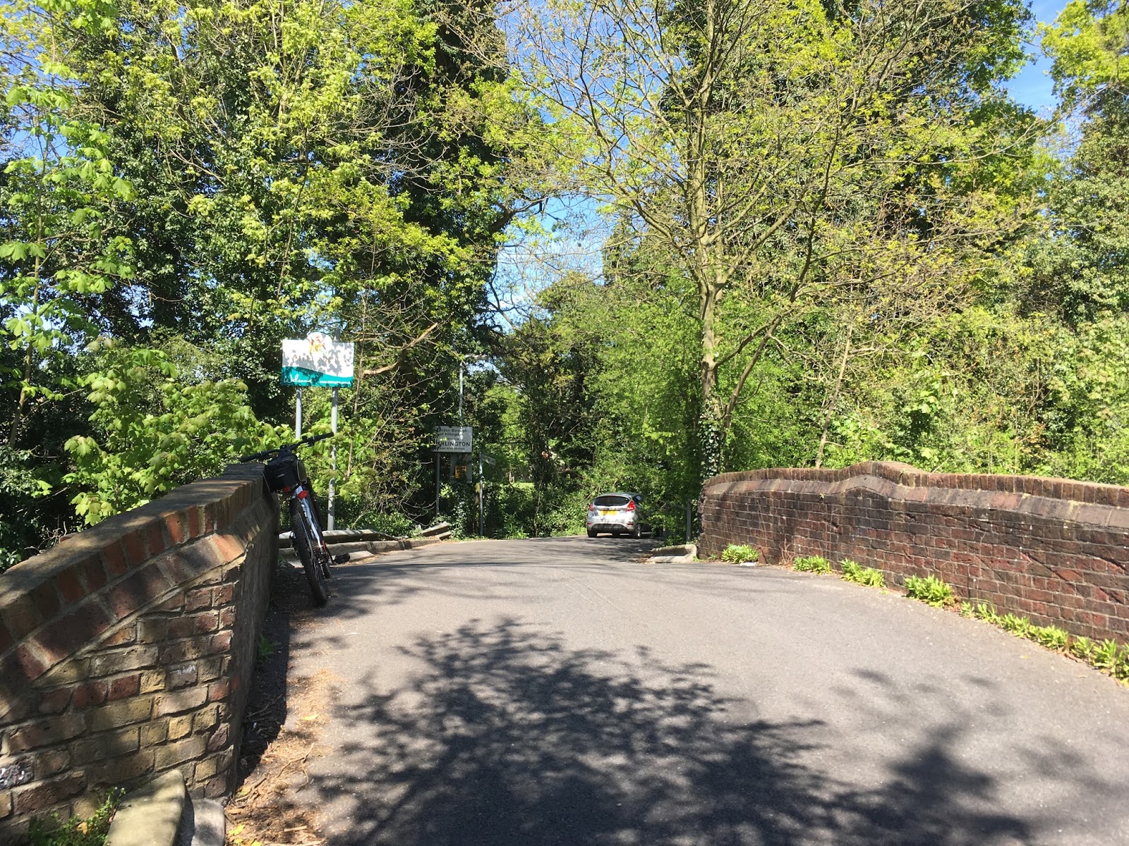
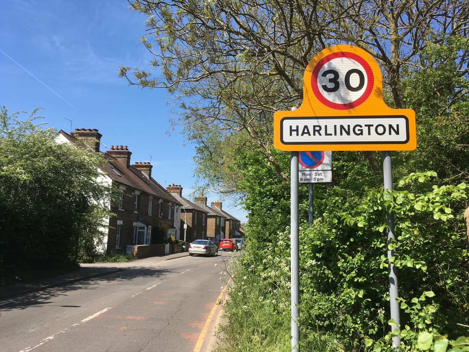
Heading west out of Cranford, and crossing the little stone bridge over the River Crane, I now found myself in Harlington, a small village which forms part of the neighbouring borough of Hillingdon, and includes the glorious landscapes of Cranford Country Park and Berkley Meadows. The latter takes its name from the wealthy family that once owned Cranford Manor.


The Bridge over the River Crane
(on the border between Hounslow and Hillingdon)


The journey west from Harlington to Sipson can seem repetitive at times, but as it is surrounded by fields on both sides it makes for an infinitely preferable route to riding along Bath Road, the busy dual carriageway which borders the airport to the south. 


The King William pub sits in the centre of Sipson, 
at the corner of the road to Harmondsworth

My journey took me through the small village of Sipson, which about ten years ago faced the prospect of complete destruction to make way for a third runway for the airport to the south. Due to a fierce campaign waged by a broad coalition of local campaigners and assorted eco warriors Sipson - including its church and local pub - still stands today.


A row of cottages in the heart of Harmondsworth village


On the road leading out of Harmondsworth village to the nearby Harmondsworth Moor

I ended the ride on this particular day in Harmondsworth village, which I still find striking in its traditional charm. There is a lot of beauty in this region, and I would urge anyone reading this to take the time to experience it themselves.

More doodles to follow soon.